
|
|

|
|
|
PLEASE NOTE: the waymarked Poole Harbour Trail is not a cycle trail except where it follows bridleways or shared paths. Cyclists should only use rights of way specified for their use. Please see our cycling page for our suggested cycle routes.
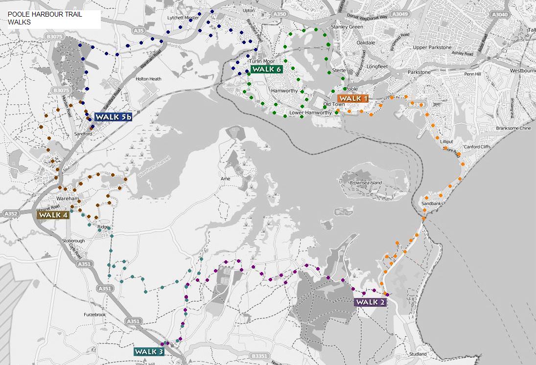
You can walk all the way round Poole Harbour on existing paths, as shown here using our descriptions. Download the 6 descriptions using the buttons below. Choose the illustrated leaflets fully updated in 2017, bursting with interesting information about the walks, or the Word versions for recently updated, shorter documents that you can annotate yourself.
There are waymarks, in the form of small, green roundels, in place for the more important junctions of the linear walks that make up the Poole Harbour Trail but not for our circular walks.
We dislike clutter in the countryside so have not added posts where there are none leaving some gaps in the waymarking.
| WALK 1 | WALK 2 | WALK 3 |
| WALK 4 | WALK 5b | WALK 6 |
| WALK 1 | WALK 2 | WALK 3 |
| WALK 4 | WALK 5b | WALK 6 |
For your own choice of walk, use the recently updated Ordnance Survey maps, which show the whole trail. For those unfamiliar with map reading there is some useful information given by Ordnance Survey here
Transport
The start and finish points of the described walks are at bus stops. Please check the bus timetables because times of buses and even their routes change from time to time. Here is the web site of More Bus from Wilts and Dorset.
Several parts of the trail can be reached from train stations, Poole, Wareham, Hamworthy and Holton Heath, but be careful, some of the ticket machines take only cards.
Use the Swanage Railway
Watch the progress of the Swanage to Wareham extension of the Swanage Railway.
Wherever you walk, always follow the Countryside Code as updated on 1st April 2021. If you are taking a dog with you, you will find a lot of useful information on the Dorset Dogs website.
See also our preferred WALK 5.
See also our circular walks.
If you have a GPS and tracklogs software, you can download the walks here as gpx files. Right click button below and use Save Link As or Save target as. With some operating systems you may need to change the file extension back to .gpx after saving.
| WALK 1 as gpx | WALK 2 as gpx | WALK 3 as gpx |
| WALK 4 as gpx | WALK 5b as gpx | WALK 6 as gpx |
| Whole trail as gpx |
Or please ask us for the tracklogs in your favourite format.
Page last updated 4th June 2025.